
Ever wondered where the world's first cities were? This animated map shows how urban civilizations developed over a time span of nearly 6,000 years.
Blogger Max Galka created the visualization for his Metrocosm site using data from a new study published in the journal Scientific Nature Data. It charts how cities popped up, one by one, from as far back as 3700 BC to the year AD 2000.
The study, led by a Yale-based team, collates data from previous research on city locations and populations dating back almost 6,000 years. According to the researchers, until now there had be no comprehensive digitized record of historic city populations at a global scale.
The study allows us to view our urban history over a much longer time frame than ever before, beginning with the first urban civilization (the Sumer, who lived in the southern-most part of ancient Mesopotamia; now Iraq) through to modern-day megacities.
Studying the rise and fall of cities over millennia can help to give us a better understanding of urbanization – often referred to as a modern phenomenon, but one that in reality has been going on in parts of the world for thousands of years.
How cities spread
As the study puts it: “In order to understand the current era of urbanization, we must understand long-term historical urbanization trends and patterns.”
For the first few thousand years after the establishment of sprawling agricultural populations around the Nile, cities remained roughly in the same latitudinal area as Mesopotamia.
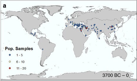
As the map below shows, by 3700 BC urban settlements had begun to spread further east to what is now India and China, also emerging in Central America.
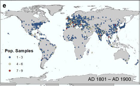
But it was not until the 19th century that urbanization became a truly global phenomenon.
Have you read?
This map shows the incredible growth of cities
The global movement of people, all in one map
Which are the world’s migration mega-cities?